 Catálogo Nacional de Metadatos
MAPA BASE DEL PERÚ 1 : 100 000
Mapa base del Perú a escala 1:100 000 que contiene Información visual de vectores clasificados por Capas; estos vectores son: Transporte y Comunicaciones, Cultural, Hidrografìa y Fisiografìa.
Simple
- Date (Publication)
- 2018-01-15T10:02:00
- Purpose
-
INFORMATIVO
- Status
- Completed
- Point of contact
-
Organisation name Individual name Electronic mail address Role INSTITUTO GEOGRÁFICO NACIONAL
IGN
Originator
- Maintenance and update frequency
- As needed
- Theme
-
-
PERÚ AL 100K
-
MAPA TOPOGRÁFICO DEL PERÚ 1 :100 000
-
CARTOGRAFÏA BÁSICA
-
MAPA BASE
-
- Access constraints
- Copyright
- Use constraints
- otherRestictions
- Other constraints
-
Ninguna
- Spatial representation type
- Vector
- Denominator
- 100000
- Language
- Spanish; Castilian
- Character set
- UTF8
- Topic category
-
- Imagery base maps earth cover
N
S
E
W
))
- Begin date
- 2015-01-01
- End date
- 2015-12-28
- Supplemental Information
-
Mapa de Información Vectorial del Perú a escala 1 : 100 000
- Reference system identifier
- WGS 1984
- OnLine resource
-
Protocol Linkage Name WWW:LINK-1.0-http--related
https://www.idep.gob.pe/geoportal/services/MAPA_BASE/PERÚ_RASTER_100K/MapServer/WMSServer? SERVICIO WMS
WWW:LINK-1.0-http--link
https://www.idep.gob.pe/geovisor/descarga/visor.html Descarga de Cartas Nacionales
- Hierarchy level
- Dataset
- Statement
-
Conjunto de Datos
Metadata
- File identifier
- 8619d17a-3810-4b7c-9f02-25da971ff3bd XML
- Metadata language
- Spanish; Castilian
- Character set
- UTF8
- Date stamp
- 2022-07-11T15:01:09
- Metadata standard name
-
ISO 19115:2003/19139
- Metadata standard version
-
1.0
- Metadata author
-
Organisation name Individual name Electronic mail address Role Centro de Infraestructura de Datos Geoespaciales
Publisher
Overviews
Mapa Base del Perú Escala 1 / 100 000
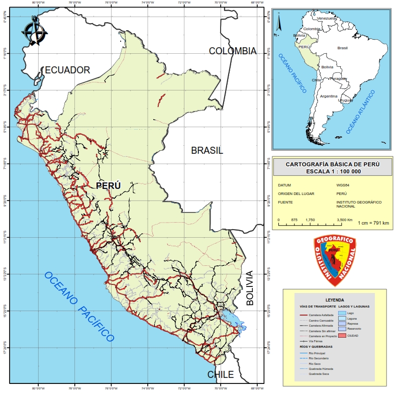
Mapa base cartográfico del Perú a la escala 1 : 100 000
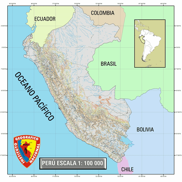
PERÚ 1:100 000
Spatial extent
N
S
E
W
Provided by