 Catálogo Nacional de Metadatos
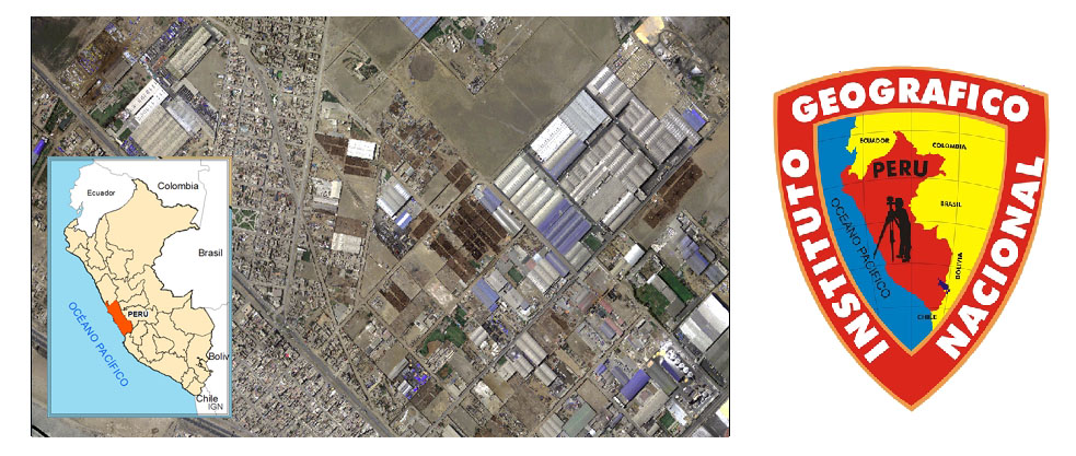
ORTOFOTO LURIN
Ortofoto de una parte del departamento de Lima ( LURIN ) tomada con un drone, se encuentra a la escala 1 : 1000.
Simple
- Title
- ORTOFOTO LURIN
- Creator
- Instituto Geográfico Nacional
- Subject and Keywords
- ORTOFOTO DRONE LURIN
- Subject and Keywords
- LURIN
- Subject and Keywords
- OROFOTO
- Subject and Keywords
- 1 : 1000
- Description
- Ortofoto de una parte del departamento de Lima ( LURIN ) tomada con un drone, se encuentra a la escala 1 : 1000.
- Publisher
- Instituto Geográfico Nacional
- Contributor
- Instituto Geográfico Nacional
- Date
- 2017
- Resource Type
- Mapas y Gráficos
- Format
- Web page
- Source
- Instituto Geográfico Nacional
- Language
- spa
- Relation
- Unknown
N
S
E
W
))
- Rights Management
- No restrictions
- Related resource
- https://www.idep.gob.pe/url/geonetwork/orto_lurin.jpg
- Date Modified
- 2019-09-26T15:42:25
- Resource Identifier
- 518b39b3-744d-4ea9-a153-5df2bffed9c8