 Catálogo Nacional de Metadatos
HOJAS DE EMPLAME - CARTA NACIONAL DEL PERÚ 1 : 100 000
El cuadro de empalmes de la Carta Nacional Topográfica a escala 1:100,000 está conformada por 501 Hojas, los cuales fueron cartografiados. Cada mapa topográfico o grupo de cartas (Carta Topográfica Nacional), en el que se brinda información objetiva en TLM (topology Lineal Map).
Simple
- Date (Publication)
- 2018-02-05T10:02:00
- Purpose
-
INFORMATIVO
- Status
- Completed
- Point of contact
-
Organisation name Individual name Electronic mail address Role INSTITUTO GEOGRÁFICO NACIONAL
IGN
Originator
- Maintenance and update frequency
- As needed
- Theme
-
-
PERÚ AL 100K
-
MAPA TOPOGRÁFICO DEL PERÚ 1 :100 000
-
MALLA TOPOGRÁFICA
-
CARTA NACIONAL
-
CUADRO DE EMPALME 1 : 100 000
-
- Access constraints
- Copyright
- Use constraints
- otherRestictions
- Other constraints
-
Ninguna
- Spatial representation type
- Grid
- Denominator
- 100000
- Language
- Spanish; Castilian
- Character set
- UTF8
- Topic category
-
- Imagery base maps earth cover
N
S
E
W
))
- Begin date
- 2018-03-02
- End date
- 2018-03-05
- Supplemental Information
-
Mapa de Información Vectorial del Perú a escala 1 : 100 000
- Reference system identifier
- WGS 1984
- OnLine resource
-
Protocol Linkage Name WWW:LINK-1.0-http--link
https://www.idep.gob.pe:6443/arcgis/rest/services/DATOS_GEOESPACIALES/CUADRO_DE_EMPALMES/MapServer Perú 1:100 000
- Hierarchy level
- Dataset
- Statement
-
Conjunto de Datos
Metadata
- File identifier
- 3ba46c1c-0f6d-41a7-b1a3-1b088e431192 XML
- Metadata language
- Spanish; Castilian
- Character set
- UTF8
- Date stamp
- 2019-08-19T10:57:21
- Metadata standard name
-
ISO 19115:2003/19139
- Metadata standard version
-
1.0
- Metadata author
-
Organisation name Individual name Electronic mail address Role Centro de Infraestructura de Datos Geoespaciales
Publisher
Overviews

CUADRO DE EMPALME DEL PERÚ A LA ESCALA 1 / 100 000
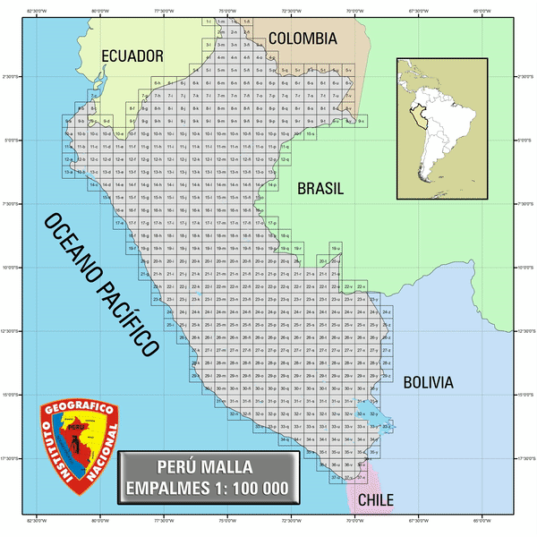
MALLA EMPALME 1:100 000
Spatial extent
N
S
E
W
Provided by